ERRATUM
Chris E. WhiteDepartment of Natural Resources, P.O. Box 698, Halifax, Nova Scotia B3N 2T9
Sandra M. Barr
Department of Geology, Acadia University, Wolfville, Nova Scotia B4P 2R6 Canada
Brent V. Miller
Department of Geological Sciences, University of North Carolina, Chapel Hill, North Carolina, USA 27599-3315
Michael A. Hamilton
Geological Survey of Canada, 601 Booth Street, Ottawa, Ontario K1A 0E8
Date received: August 27, 2002 ¶ Date accepted: December 12, 2002
Granitoid plutons of the Brookville terrane, southern New Brunswick: petrology, age, and tectonic setting
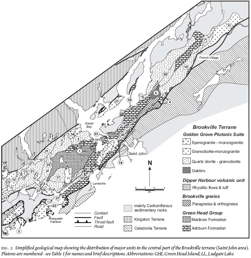
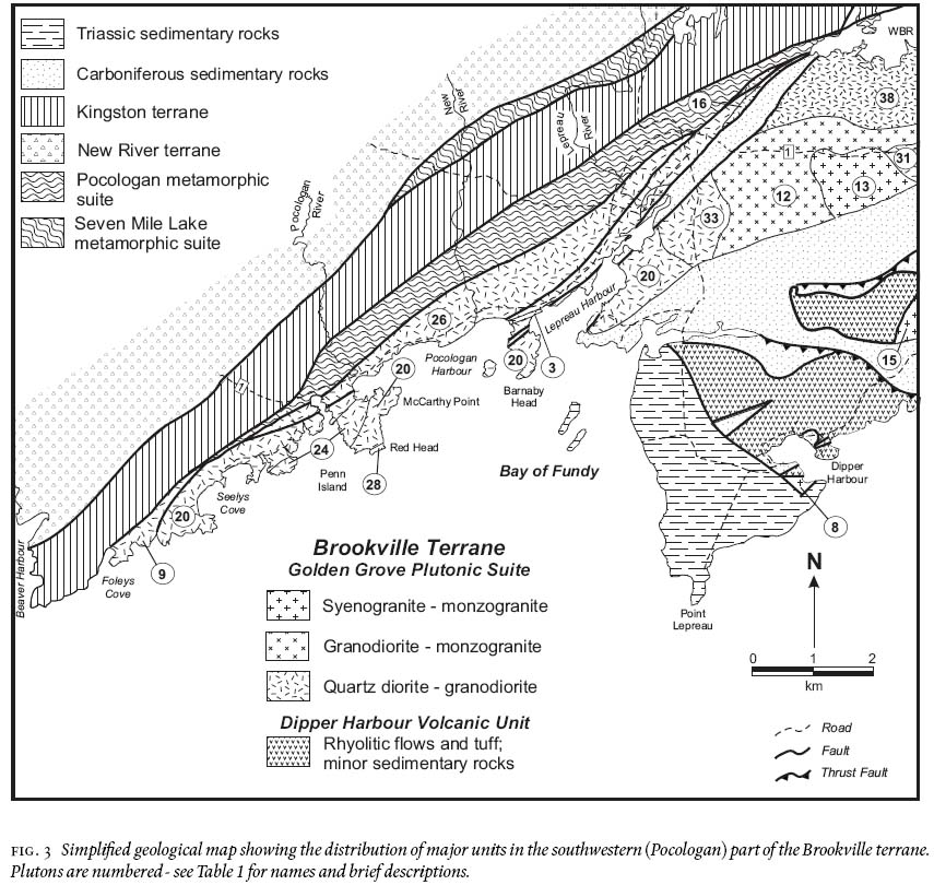
Please note that Figures 1, 2 and 3 of White et al., published in Atlantic Geology, Volume 38, No. 1, pages 54, 55, and 58, were printed with insufficent contrast. The figure and caption are reproduced here.
Fig. 1 Location of the Brookville and adjacent terranes in southern New Brunswick. Abbreviations: CCHF, Caledonia-Clover Hill Fault; CL, Cassidy Lake inlier; G, Gaytons Granite; JC, Jeffrey Corner inlier; KF, Kennebecasis Fault; LC, Lower Coverdale Gabbroic Complex (in subsurface); LM, Lutes Mountain.
Display large image of Figure 1