GAC-MAC 2013: Field Guide Summary
Ordovician-Silurian Boundary Interval in the Williston Basin Outcrop Belt of Manitoba:
A Record of Global and Regional Environmental and Biotic Change
FIELD TRIP OBJECTIVES
1 During latest Ordovician to earliest Silurian time, deposition and biotas were influenced globally by environmental changes that led to glaciation and subsequent deglaciation in south-polar Gondwana. At the centre of equatorial Laurentia, the Williston Basin provides a record of global and regional change in an epicontinental sea. Classic localities in southern Manitoba will be compared with sites north of Grand Rapids and northeast of The Pas, including the only known exposures of the Ordovician – Silurian boundary in this vast basin. New research, integrating lithostratigraphy, biostratigraphy, and C-isotope stratigraphy, suggests that deposits of latest Ordovician (Hirnantian) age are present and that the Ordovician – Silurian boundary is at a higher position than previously thought.
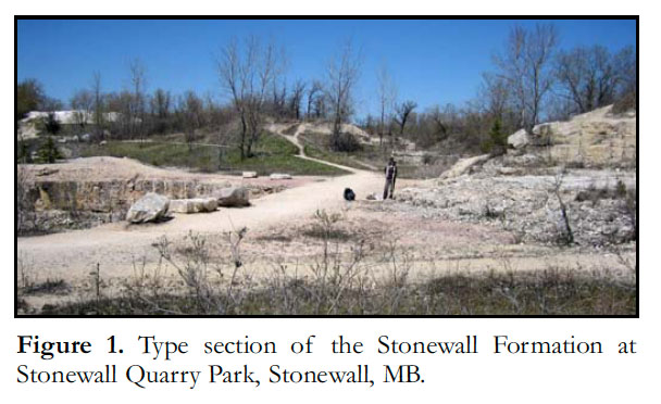
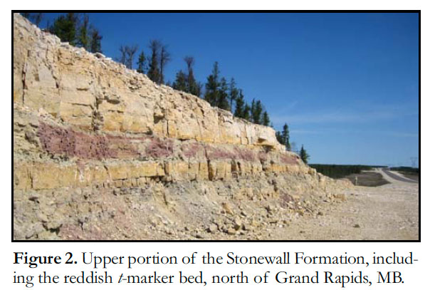
2 Strata exposed in southern and west-central Manitoba provide a superb opportunity to examine this extraordinary time in Earth’s history. This field trip will focus on the Stony Mountain, Stonewall (Figs. 1, 2), and Fisher Branch formations. These predominantly carbonate strata record environments and events leading up to and following the major Hirnantian glacial episode. The succession of fossils represents the culmination of the ‘Great Ordovician Biodiversification Event’, the Late Ordovician mass extinction, and the Early Silurian recovery. The Williston Basin outcrop belt in Manitoba provides a dip section, from relatively basinal deposits in the south to more marginal in the north. On Day 1, we will visit the type sections of the three formations in the southern part of the outcrop belt. Exposures of correlative strata in two areas within the northern part of the outcrop belt will be examined on Days 2 and 3.
 Display large image of Figure 1
 Display large image of Figure 2
3 This field trip complements several GAC–MAC 2013 Special Sessions, including Williston Basin and Other Intracratonic Basins – Sedimentology, Stratigraphy, Paleontology and Resources; Advances in Phanerozoic Geoscience in the Hudson Bay Basin, Foxe Basin and Hudson Strait; and Evolving Carbonate Environments from Precambrian to Modern: Sedimentological and Geochemical Perspectives; and the symposium on Life and Times of Phanerozoic Seas (in Honour of Rolf Ludvigsen).
OTHER INFORMATION
4 The round trip by minivans in southern and west-central Manitoba will be about 1700 km, with stops at easily accessible roadcuts, outcrops, and abandoned quarries. The longest round-trip hike will be about 1 or 2 easy km. We will be visiting these sites over three days beginning on May 25, so there will be substantial driving time and each day will be rather long. The trip will end late on May 27, so do not plan subsequent travel on that day.